Annual Holiday Craft Fair


By: Tammy Whitty-Brown

Tis (almost) the season!

As I sit here on my porch looking out over the sparkling waters of Palmer Pond, it is hard to believe that Christmas is only forty-six days away. It is sunny and nearly 60 degrees today. This year, the Adirondacks have been blessed with a warm and beautiful fall. However, in contrast, the cool crisp evening air lets us know that “ol’ man” winter is just around the corner. Soon, falling snowflakes, frigid cold air, sparkling holiday lights, and amazing colorful decorations will begin to pop up - and the smell of pumpkin and spice and everything nice will be upon us.

The Schroon Lake Region is no exception, soon it will be a magical winter wonderland as home owners and local businesses begin to deck the halls. One of my favorite pastimes is to drive around the region and see all the holidays decorations and lights, this year will be no exception.

Kick off your shopping with the Holiday Craft Fair

As soon as the decorating is done, the stores will take inventory and make sure that their shelves are stocked with those special items that will make great gifts for everyone in your family. Local organizations are planning events for the holidays that are an annual affair, for example, the Schroon Lake Ladies Auxiliary will be holding their annual Holiday Craft Fair at the Schroon Lake Fire House this Saturday, November 14, 2015 from 10am to 4pm.

[img:lazymoosemarket3.jpg]

Variety is key (and cookies help)!

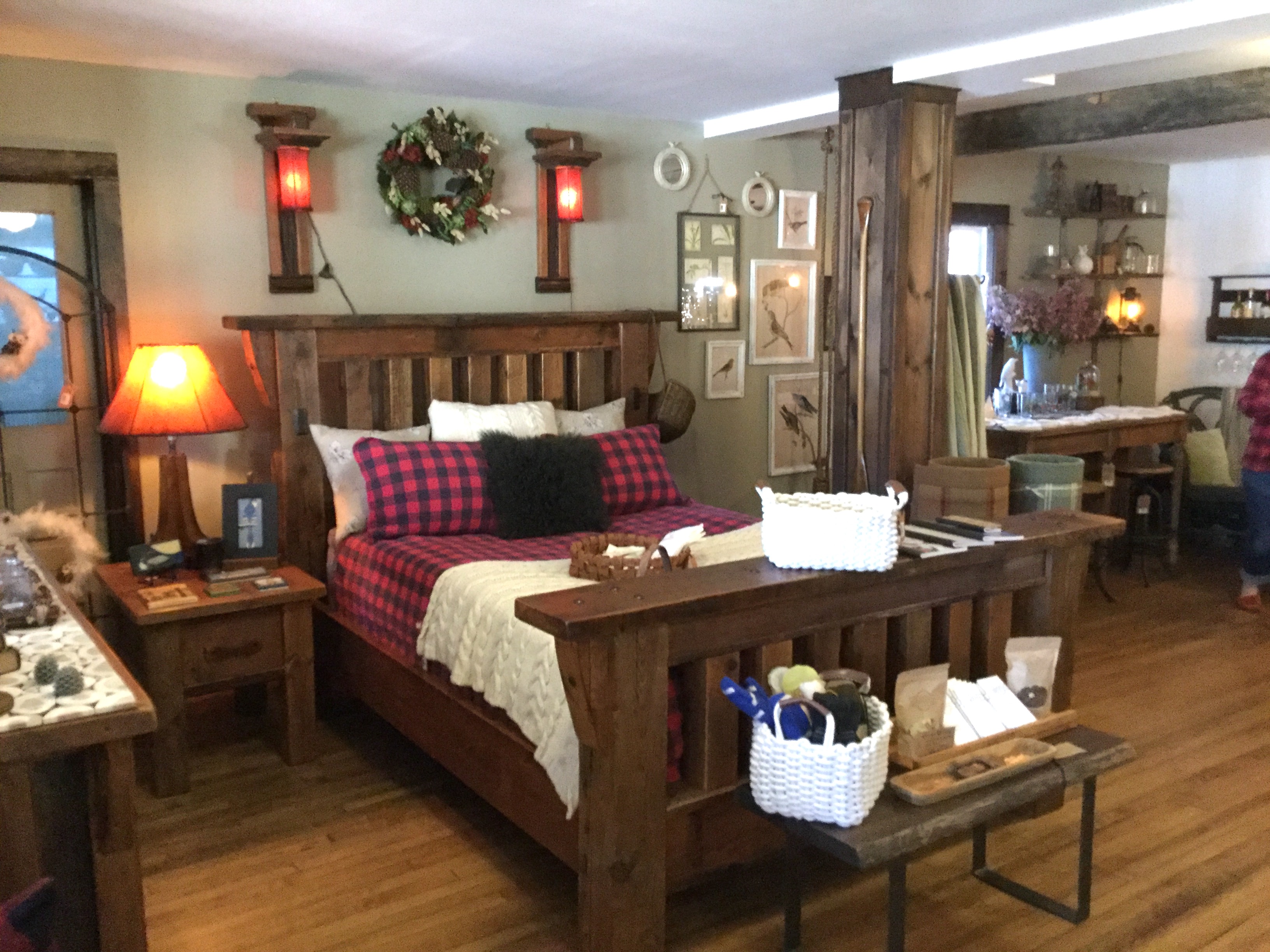
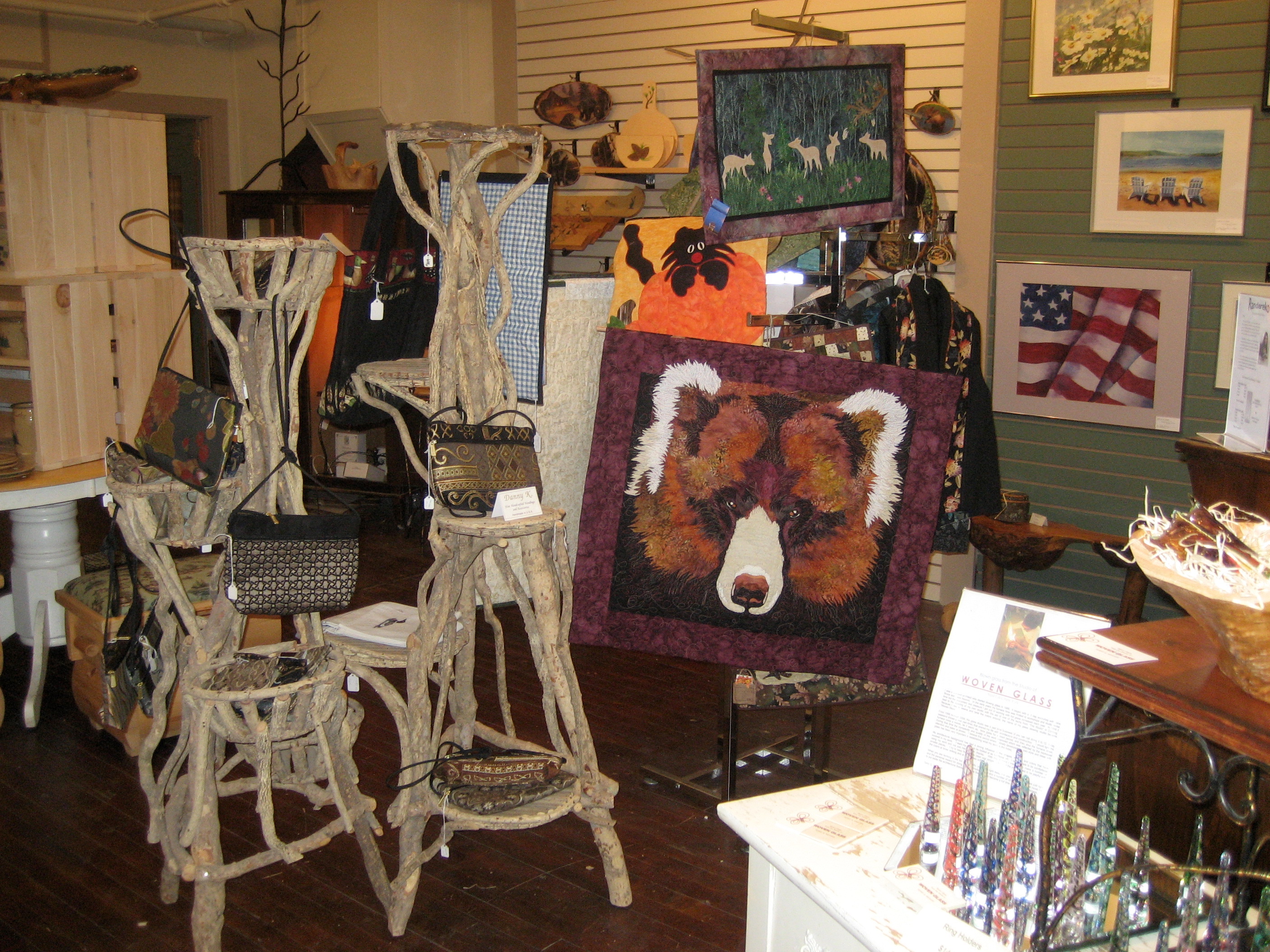
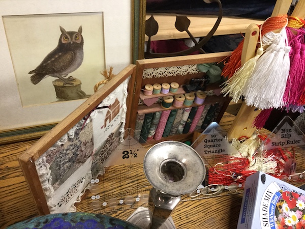
The Holiday Craft Fair is one event that EVERYONE loves to attend because it gives shoppers the opportunity to browse a vendor-packed firehouse with a wide variety of items from homemade crafts ranging from holiday cards, ornaments, and art work, to lotions, candles, dishes, tote bags, and so much more.

In addition to providing an amazing shopping opportunity, the Auxiliary ladies hold an Annual Cookie Walk. You will not want to miss this opportunity - and it's simple to get into the action: Donate a tray of cookies and then take the cookie walk, fill a box and pay by the pound - you'll head home with a tray of assorted holiday cookies that are sure to tease and tantalize your palate. All you need to bring is a tray to share. Throughout the day as you are shopping and doing the cookie walk, don’t forget to enjoy the Ladies Auxiliary luncheon. This is a great opportunity to catch up with friends and family, and even make new friends! For more information about this event you can call Kathy at (518) 351-0020.

Ready to join us in a kick off to a great holiday season? Book your lodging now, watch our calendar for all of the great upcoming local events - we are constantly adding information, and be sure to get social with us on our Schroon Lake Region Facebook page!


Now There's More to Gore

Eventually every season makes way for the next. In the Adirondacks, the brilliance of autumn disappears as the days grow shorter. Soon the smell of snow is in the air and skiers and boarders begin dreaming of perfect turns and fluffy powder. I may be just now thinking of winter, but the good folks over at Gore Mountain have been thinking about winter all summer long.

Gore Mountain boasts the most skiable acreage in the East with 438 acres of trails and glades. One of those glades, Cirque, is the longest in the east. With all of these superlatives, it would be understandable if the Gore Mountain crew wanted to take a summer off and rest on their laurels, but that’s not their style. They’ve put in a lot of work while the rest of us have been swimming. Here’s a few of the major improvements:

[img:skiing-gore-mtn.jpg]

New Trails

The Gore crew added three new trails to the mountain.

    • Forever Wild - Using the natural terrain and enhancing it with park elements, this will be a one-of-a-kind experience matching the fun of a terrain park with the excitement of tree skiing.
    • Hudson - One of the original trails in the North Creek Ski Bowl has been retooled into a long, narrow black diamond trail.
    • The Peace Pipe - A new traverse trail connects North Side of Gore to the Pipeline Traverse, making it easier for skiers and boarders to get to their favorite runs.

MORE GORE (Snow Guns)!

Snowmaking efforts are being expanded with the addition of high-efficiency tower guns on the Showcase and Wild Air trails. Even though Gore gets its fair share of natural snowfall - averaging 150 inches annually - the quicker Gore can get the trails covered, the better. East coasters know that snowmaking can make the difference between a good season and no season. Gore continues to invest in its snowmaking technology to insure that it says ahead of mother nature.

[img:nicoleatgoreterrainpark.jpg]

Moving Heaven & Earth (or just Earth)

The Headwaters trail is one of the most heavily trafficked trails on the mountain. Gore spent significant time moving the dirt around to smooth it out. While this may seem like an odd thing to do (aren’t bumps a good thing?), the result is that it will take less snowmaking to open the trail. Spring skiers will also reap the benefits as the trail will remain in better condition further into the spring.

The physical mountain itself is only part of the package. As every skier and boarder knows, the facilities at the bottom of the slopes play a big part of a great day at the mountain.

Be Our Guest

The Guest Services Office has a new home at the resort entrance. Gore Mountain hopes that this will enable them to greet and provide info to guests in a more efficient manner. For first-time visitors this will mean less time wandering around, and more time on the slopes!

Want to go skiing but have the tykes in tow? The Bear Cub Den Daycare has been relocated to the lower level of the Base Lodge, making it more convenient for parents and more fun for the kiddos.

[img:bar-at-gore-local-scene.jpg]

Get Connected

There’s no point in taking that slomo video of your friend Jerry faceplanting in the terrain park if you can’t post it for the world to see. The complimentary wifi has been upgraded to make getting online easier than taking the perfect selfie.

Fun with the Sun

Gore Mountain has been working with Berrego Solar to meet its power needs. This means that more and more of the power required to spin lifts and blow snow will be coming from clean, renewable solar energy. Gore is dedicated to helping protect our winters while still providing a top-notch experience.

Truth be told: I’ve never been to Gore. I’ve always tried to squeeze in as much riding as possible every winter, but with work and family schedules I’ve had to stick close to home. Luckily for me, that means Whiteface Mountain. So you may be wondering why I’m writing about Gore if I’ve never been. That’s a valid question. I’ve heard a lot about Gore from my friends that travel more than I do. They talk about the glades, the snowfall, the fun. And I’ve always been jealous. AND THEN Gore decides to go and make things EVEN BETTER! I was literally - well, almost literally - drooling while reading about the improvements. I can’t wait for winter to get here so I can check out Gore for myself. Maybe I’ll tell you about it, but maybe you should check it out for yourself!

So there you have it. Gore Mountain was the perfect winter fun destination last year, and with these improvements, 2016 is going to be even better. So book a stay in Schroon Lake so you can be first in line on the next powder day. Better yet, a Gore Mountain ski and stay getaway!


SELECT SEVEN: Family hikes in the Pharaoh Mountain Wilderness

We know how to make fun family memories in the Schroon Lake Region!

Try one of these 7 hikes and let us know what you think!


Goose Pond

Distance Roundtrip/Loop: 3.0 miles

Estimated Time Roundtrip/Loop: 2 hours

Brief Overview

From the parking area you will walk along Crane Pond Road for around a mile to the Gull Pond Trail on the right. The road is an easy walk and so is the trail; small rolling hills bring you to a very scenic back-county pond.

[img:pharaoh-from-goose-pond.jpg]


Other Notable Features

If you have time, be sure to check out Crane Pond just a bit further up the road.

How to Get There

In Schroon Lake follow Alder Brook Road to Crane Pond Road which will be on your left. Follow Crane Pond Road to the large parking area. Note: Don’t try to drive any further along Crane Pond Road - it is far too rough for most vehicles and is part of a wilderness area that should not be driven.

Gull Pond

Distance Roundtrip/Loop: 1.0 miles

Estimated Time Roundtrip/Loop: 1 hour

Brief Overview

From the trailhead you will have an easy hike on a mostly flat surface back to one of the most scenic gems of the Adirondacks. This small pond is a wonderful afternoon destination.

[img:gull-2.jpg]


Other Notable Features

This pond makes for a great swimming hole on a hot day, as well as a wonderful spot for a picnic lunch.

How to Get There

From Schroon Lake follow Alder Brook Road to its end where it becomes Adirondack Road (right at Y-intersection with Crane Pond Road). Follow Adirondack Road to the trailhead on the left.

Treadway Mountain

Distance Roundtrip/Loop: 7.8 miles

Estimated Time Roundtrip/Loop: 4 to 5 hours

[img:treadway.jpg]

Brief Overview

From the Putnam Pond Trailhead start a moderate and easy hike around the pond. There are a few intersections along this route to the mountain so be sure to take notice of the trail signage. The climb is moderate with only a couple spots that would be considered steep. The summit and the approaching ridge are loaded with rock outcroppings and views, take them in.

Other Notable Features

If you find the summit more crowded than you like, there are plenty of spots to have some privacy and quiet. Be sure to explore the ridge for additional hidden views of the neighboring lakes and mountains.

How to Get There

From Schroon Lake follow Route 74 toward Ticonderoga. Take a right onto Putts Pond Road and follow to the end at the state campground. Once through the gate of the campground continue straight to the top of the hill, the parking area is on the left.

Grizzle Ocean Loop

Distance Roundtrip/Loop: 5.0 miles

Estimated Time Roundtrip/Loop: 2.5 to 3 hours

[img:grizzle.jpg]

Brief Overview

From the Putnam Pond Trailhead start a moderate and easy hike around the pond. There are several intersections along this route to the loop so be sure to take notice of the trail signage which is quite clear. The majority of the hike is flat - aside from one longer section of moderate climbing to the shoulder of Grizzle Ocean Mountain. Do the loop in either direction; you can’t go wrong on this lollipop.

Other Notable Features

Be sure to look for wild cranberries along the shore, they make for a nice tart snack.

How to Get There

From Schroon Lake follow Route 74 toward Ticonderoga. Take a right onto Putts Pond Road and follow to the end at the state campground. Once through the gate of the campground continue straight to the top of the hill. The parking area is on the left.

Bear Pond Loop

Distance Roundtrip/Loop: 6.1 miles

Estimated Time Roundtrip/Loop: 3 to 3.5 hours

Brief Overview

From the day-use parking area locate the foot trail across the grassy area and past a couple of buildings. You will come to the road through the campground, follow it left to the trailhead, there is no parking at the trailhead.

The trail for quite some time is flat. You will pass by Heart Pond on your left - at the trail intersection with Rock Pond. Not far past Heart Pond the trail ascends a bit to a height-of-land. The descent to the pond is fast and a bit steep. The pond is a gorgeous back-country gem that shouldn’t be missed. There is a climb once you leave the pond that will bring you up and over the pass. The trail will bring you down to the Rock Pond Loop where you take a left and follow the signs back to the campground. This is a lollipop loop that will bring you back to Heart Pond.

[img:bear.jpg]

Other Notable Features

This loop is a sure-fire gem of a trail that gets little attention so you will have most of the hike to yourself.

How to Get There

From Schroon Lake follow Route 74 toward Ticonderoga. Take a right onto Putts Pond Road and follow to the end at the state campground. Once through the gate of the campground take a right and locate the day-use parking area near the beach.

Rock Pond Loop

Distance Roundtrip/Loop: 6.8 miles

Estimated Time Roundtrip/Loop: 3.5 to 4 hours

[img:rock.jpg]

Brief Overview

From the day-use parking area locate the foot trail across the grassy area and past a couple of buildings. You will come to the road through the campground, follow it left to the trailhead, there is no parking at the trailhead.

The path is flat for quite some time as you pass by the trail to Bear Pond. Be sure to make a quick visit Heart Pond which will be on your right, another great waterbody. The rolling hills will bring you past North Pond, and then downhill to the Rock Pond Lollipop loop. I enjoy it in a counterclockwise direction, but either way is quite good. On the back side of the pond the historical buff in you will enjoy a visit to an old mine shaft - it’s a cool spot on a hot day. Once past the shaft the trails gets a bit more serious for a while as it climbs up and over several rocky outcroppings and along a narrow path above a steep drop, this is a fun section for sure.

There are a few rock outcroppings with great places to sit and relax most of the way around the pond. The backside of the pond is a much mellower walk with excellent footing and even more scenic spots. There is a neat floating bridge that crosses the gap between Rock Pond and Little Rock Pond.

Other Notable Features

This is a great pond for a cooling dip or a nice afternoon picnic.

How to Get There

From Schroon Lake follow Route 74 toward Ticonderoga. Take a right onto Putts Pond Road and follow to the end at the state campground. Once through the gate of the campground take a right and locate the day-use parking area near the beach.

Pharaoh Mountain

Distance Roundtrip/Loop: 9.8 miles

Estimated Time Roundtrip/Loop: 6 to 7 hours

[img:view.jpg]

Brief Overview

This hike might be a bit long for some families, but it depends on the age and ability of the children involved. From the parking area you will hike an access road to Crane Pond, which is a nice place to take a break. From there you will hike on a moderate foot trail past Glidden Marsh which offers tremendous scenic value.

The climb to the summit is a bit more demanding, and in some areas could be considered quite steep. Some visitors consider this hike moderate, others strenuous, I would say it’s someplace in the middle. The views are stupendous and the regularity of visitors is a prime example of how wonderful the top truly is. This mountain is the highest point in the Pharaoh Mountain Wilderness, imagine that!

Other Notable Features

The summit used to have a fire tower on it, look for the old concrete footers and other evidence of a fire tower observer.

How to Get There

In Schroon Lake follow Alder Brook Road to Crane Pond Road which will be on your left. Follow Crane Pond Road to the large parking area. Don’t try to drive any further along Crane Pond Road it is far too rough for most vehicles, and it is in a wilderness area that shouldn’t be driven.


Pick your path!

Plan your next Adirondack hiking trip for the Schroon Lake Region! We have great places for you to eat after a day on the trails, and comfy places to rest your weary bones.

Hunting: A Deep Family Tradition

The Oxford Dictionary defines hunting with this definition: “To pursue and kill a wild animal for sport or food." Here in the Adirondack Hub, and Adirondacks overall, the majority of residents hunt for the food first, and sport second. It is a way of life, and has been since the first settlers came here in the early 1800s. The ground was too rocky and sandy to farm. The families had to be rugged and tough, relying on their hunting and fishing skills to survive. Our forefathers farmed what little land they could and hunted in the fall to feed their families for the winters. Many of the great hunters became guides for the tourists that flocked to the Adirondacks in the early 1900s to experience the last of the wild wilderness.

Growing up at the original homestead of the Whitty’s at Schroon River Falls (north of Schroon Lake, just before the North Hudson town line), I was blessed with a father that took great pride in teaching me the skills to survive in the woods. Knowledge was passed down from his father, grandfather, and great-grandfather. John Whitty, my father’s great-grandfather, came to Schroon Falls sometime around the late 1830s from Ireland. His son Nicholas became one of the leading guides in this region for many years, and the Whitty home and farm became a boarding house during hunting season.

As early as I can remember, my father took me for hikes in the woods. Among other things, he taught me how to read the sun as we walked through the woods, a skill that still boggles my husband’s mind. To this day, I can wake up at any time of the morning and pretty much tell you what time it is by how much sun is coming in the windows and from what direction. Dad also taught us that the sun can tell you what direction you are going by studying where it is located that time of the day.

[img:al-decesare-and-family-teaching-the-generations-from-forever-wild-outfitters-and-guide-service.jpg]

I not only learned to read the sun, but he taught me how to take shelter if I got caught in the woods for the night, how to look for moss on the trees (moss normally grows on the north side of the trees in the northern hemisphere due to less sunlight), how to build a fire with nothing, how to deal with wild animals if they approach, and how to track animals: watching for their prints, broken branches, bedded down grass, and their scat. I could identify animal scat (poop) by the time I was five or six. And the entire time these lessons were being taught and we were walking in the woods, he was telling me great hunting stories handed down from his father, grandfathers, and great-grandfathers. And I clung to every word.

Tradition

The first time I had a rifle placed in my hand I was approximately eight years old. Dad took me down to the field along the river at the homestead, set up some targets and loaded the 22 rifle. It took me very little time to figure out how to pick off all the cans. I was a natural. Over the next few years I practiced fine tuning my skills with the rifle, before long I was taking cans out one right after the next. I felt like I was on an old John Wayne movie set.

Finally the time came for me to attend my NY State Department of Environmental Conservation Hunter Training Course at the Schroon Lake Fish and Game Club in September of 1980 at the age 14. (I highly recommend every teenager take this course.) It was a long three days, learning many of the same skills my dad had already taught me, but learning more in-depth their importance to safety while hunting. I passed the final test with flying colors, making my father very proud. It not only felt good to be a sixth generation Whitty to be able to hunt, but I was one of only three girls in a class of twenty–seven boys and men that year.

[img:dezalia-brothers-the-dezalias-many-generations-of-hunters-buck-shot-by-derek-dezalia-during-archery.jpg]

My first hunting trip with my father was for small game. For those of you that unfamiliar with the difference, let me explain. Small game includes wild animals and birds, such as squirrel and pheasant. We took our first trip down to the field by the Schroon River on the family property. I attempted to shoot a pheasant, but missed! I am here to tell you that shooting a bird that is in flight is not easy. It is certainly not like shooting a standing can on a fence post. Even though I missed, I was still ecstatic that I got to go because it meant time with my father; it meant I was part of a 6th generation tradition. Over the next two years we worked on my skills, honing them in; I learned to walk softly in the woods, not talk, control my breathing, not let my teeth chatter too loudly, and to find a great spot to sit and wait where I could be dry but not seen by the animals as they travel their worn paths.

In the fall of 1982, I was invited to finally go on my first big game hunt with my father and my paternal grandfather. The destination was the Boreas River just north of the Adirondack Buffalo Company and Elk Lake Lodge in North Hudson. I was a bit nervous because this meant venturing off the family property. It meant going into new terrain. Growing up on the Whitty property, I had hiked every nook and cranny, ran through the woods barefoot from June to September, could tell you where every animal hole was, where the poison ivy was, where the streams where, where otter played, etc. But this new terrain scared me!

Just the year before one of my schoolmates (from another great hunting family) had gotten lost with his father hunting on the Boreas. The young man spent two days out in that wilderness while they searched for him. It is a territory thick with evergreen. A man could walk in and disappear for days, weeks, months, maybe forever. However, I trusted my father, and believed his training would keep me safe, so we began to get ready for our big hunt the next morning.

[img:phil-mccoy-long-time-schroon-hunter.jpg]

The morning dawned bright and early! As we stepped out of camp, the air was crisp, the ground frozen. We were bundled up; underwear, long johns, wool pants, heavy sweaters, wool jackets, wool gloves, Elmer Fudd style hat to keep our ears warm, hunting knife strapped to our sides, with our orange pocket tag bearing our hunting licenses proudly pinned to our backs. Our bellies were full with a good warm breakfast, our jacket pockets had jerky to snack on, string to tie off the deer intestines, waterproof matches (just in case), and our emergency toilet paper (YES! This is a must in the fall, leaves are pretty brittle and cold this time of the year). Our canteens with fresh water hung over our shoulders. Our ammo was in our belt, and our guns hung at our sides. We were ready for the hunt.

New grounds

As we took off my heart was pounding with excitement. I kept wondering if I was going to get my first deer (or bear) now that I was old enough to hunt big game. Was I finally going to be able to bring home food for my family like my great-grandfather, grandfather, and father had? I had my eyes open, and ears clearly tuned in as we headed up the side of the mountain through the evergreen.

I quickly went from being very excited to realizing that I needed to calm down and pay attention; the woods were swallowing my father up and I could not see him at times. Every time he disappeared I would gulp and feel a nagging feeling of dread in the pit of my stomach, but my mind would go back to the lessons he taught me.

We continued to hike deep into the wilderness, heading toward Lake Placid. We quickly found deer tracks, so we located a good place to hunker down and wait. The excitement I was feeling earlier quickly returned and I kept looking to the sky praying to my forefathers to send a nice big buck my way! Unfortunately, no amount of praying that day helped. No deer came prancing down the path!

Later in the afternoon we made our way back to camp, cold, hungry, and tired - very tired! But not disappointed! Even though we came home empty-handed we knew that we still had a couple more weeks to try, and we had had a great day of camaraderie together. I was blessed to have two men in my life that did not treat me like a girl. They treated me like a fellow hunter.

I never did bag my first buck during high school, and honestly I still haven’t. After graduation in 1984, I did not hunt again till 2008. I am now living back on family land and hope that this year my Henry Big Boy Rifle and I will take my first deer to fill our freezer for the winter. I did not avoid hunting all those years. I just never had time being a mother of three. However, I did try to teach my children as many of the lessons I had learned as I could.

[img:phil-mccoy-long-time-well-know-hunter-from-sl-with-turkey.jpg]

The children are all grown up now. My oldest daughter, son, and my step-son are avid hunters along with their spouses. My youngest daughter has been trained on how to properly use a firearm and, in time, when she and her husband leave the Navy and relocate to Michigan, I believe they too will hunt for food and sport. They understand that hunting is dangerous and a sport that should not be taken lightly and should always be respected. They also carry with them our family tradition of killing only what you need to feed your family or the families of others in need.

I am proud to have grown up in a region that is full of avid and responsible hunters. Just about every family I know feeds their family throughout the winter with the game they take. A tradition that has continued since the early 1800s.


If you are interested in hunting in the Adirondack Hub, I highly recommend taking advantage of one our our local guide services. Adirondack Mountain and Stream Guide Service, an exceptional four-season guide service, is run by the Frasier's, a father-son team with years of outstanding experience. They offer guided small game and big game hunting that is highly recommended by many of their past customers. Forever Wild Outfitters & Guide Service boasts generations of hunting & trapping experience, and is run by Fish and Game Club member Al Decesare, Jr. Contact the Schroon Lake Chamber for more information and business contact information.

Plan your upcoming hunting trip now - the woods are waiting for you to explore. You can hunt during the day and stay in one of our local accommodations. Or, if you are a seasoned hunter, you can set up an overnight camping/hunting trip with our knowledgable guides who will be happy to make your dream hunting trip in the Adirondacks come true. Have a safe and happy hunting season!

Real Live Ghost Town

The spirits call

I recently spent a full day exploring a couple of really interesting places in Newcomb. After leaving our first stop, the Adirondack Interpretive Center, we enjoyed an awesome lunch at the High Peaks Kitchen and Campground in Newcomb on Route 28N. The food is great and inexpensive, and the service is terrific. I’d recommend a stop here for breakfast or lunch since they serve both.

After lunch we headed directly to the ghost town of Tahawus, an amazing place to visit!

A spectacular drive

About 4 1/2 miles east of the High Peaks Kitchen and Campground you'll come to a sign directing you to Tahawus. After turning left onto Tahawus Road, it's about a 7 mile drive into the wilderness off Route 28N. Follow the winding road along the upper reaches of the Hudson River and the shores of Sanford Lake. The views are amazing and the scenery even more spectacular with the beautiful fall foliage the day we were there.

[img:img-7168.jpg]

A note to first time visitors - seriously don't be concerned about being on a back road going deep into the wilderness. There is plenty of traffic on this road as it leads to the major southern trailhead into the High Peaks Wilderness area. There are a lot of people coming and going on the road most of the time. The weekday we were there we met at least 5 or 6 cars coming out as we were going in and about the same when leaving. On the weekends expect to see a lot more. Trust me, you won’t be alone!

A real mining town in the wilderness

[img:img-7192.jpg]

The funny part about Tahawus (originally named Adirondac) is that it sits at the very end of this very well traveled road. I imagine that's exactly why they chose this location for the High Peaks trailhead - because the road was already there and it would save hikers seven miles!

Tahawus was the company town of the Adirondack Iron Works, an iron extraction and smelting company, operating from 1827 to 1857, after which it lay dormant for a number of decades. According to Adirondack Park Agency documents regarding Tahawus, "Throughout its existence the Adirondack Iron Works operated two farms, the blast furnace and forge, a puddling furnace, charcoal and brick kilns, trip hammers and a grist and saw mill. The Village consisted of 16 dwellings and a building with a cupola, used as a school, church and a general assembly room." The very first bank in the Adirondacks was opened in Adirondac and it was obviously a thriving community deep in the wilderness - check out the history of Tahawus, the 'moving village.' The iron business failed mainly due to the presence of another mineral in the rock, titanium, which made it difficult and expensive to get a pure iron product. Eventually AIW gave up on its operation and left it abandoned in 1857.

[img:tahawus.jpg]

It was near here in 1901, on the trail to Mt. Marcy, that Vice President Teddy Roosevelt was informed of President McKinley's imminent death from a gunshot wound, and became McKinley's successor as President of the United States (see below McNaughton Cottage).

A ghost town

Over the years, mining operations were started and halted in Tahawus or nearby, the last of which was National Lead Industries, actually down the road about a mile from Tahawus. Ironically, this company opened to mine the mineral which was partially the reason the first company failed. Forty million tons of titanium were extracted before operations ceased in 1989 and the mines closed permanently. The little town of Adirondac was left to decay.

An effort to restore and interpret the mining town is underway with at least one building being worked on and many interpretive signs erected just recently. Walkways have been constructed so the public can walk around the 50-foot-high blast furnace that remains on the hill above the wheel house. According to the interpretive sign on the observation deck above the wheel house, it housed "three overshot water wheels that drove a blast engine that forced air to the blast pipes in the furnace above, pumped water to cool the tuyeres, and powered the drop stamps on the charging bridge" of the giant blast furnace (and if you know what all that means, you're better than me). It's a mighty impressive thing to look at in person and these photos cannot do it justice. A visit to the site is totally required to understand and be a part of what once was an amazing process. The interpretive signage is very beautifully done.

[img:img-7173.jpg]

[img:img-7174.jpg]

[img:img-7194.jpg]

ABOVE - The McNaughton Cottage - Vice President Theadore Roosevelt stayed here on his trip into the Adirondacks in 1901, during which he became president.

[img:img-7193.jpg]

Do yourself a favor

You really must visit the ghost town of Adirondac (Tahawus) and see it for yourself. It's fascinating and really cool to stand in the middle of the road and imagine you're a resident in the mid-1800s. We walked and poked around a bit. The homes for the most part are completely beyond repair with the exception of McNaughton Cottage. The forest has also grown up around the buildings on the road. The homes on the other side of the river were easily viewed when I was there the last time, but not now. Only one is visible if you know right where to look.

Most of the 10 buildings, with the exception of the McNaughton cottage, are structures which were built by the Tahawus Club between 1890 and 1930. McNaughton is the only building dating back to the original Adirondack Iron Works.

[img:img-7211.jpg]

[img:img-7210.jpg]

ABOVE - the fireplace in this house is still in perfect condition!

We walked up the trail that was supposed to lead to the cemetery from the High Peaks trailhead, but were unsuccessful in finding it. It's there and you'll have to try to find it. I think it'd be pretty cool to visit Tahawus on Halloween night and see if any old miners come out to greet us!

Spend some time in the region

What better way to explore the ghost towns, back roads and everything the Schroon Lake Region has to offer than spending a few days? Check out our lodging options and book a stay while you do your exploring. See you in the woods somewhere!
Interpreting the Adirondacks


I've always been fascinated with history and the environment, so in picking a topic for this week's blog post I immediately decided to focus on one of the most amazing things Newcomb has to offer - the Adirondack Interpretive Center. It's a nice day trip from Hamilton County or Schroon Lake or Lake Placid or the Lake Champlain Region... I guess you could say it's centrally located for most points in northeastern NY! You can visit and spend lots of time poking around the AIC in the course of a day and throw in lunch as well.

Our first stop in Newcomb was the town boat landing to let our dogs out for a break and swim. It was a cold fall day, but they're labradors and they didn't care! I also discovered Newcomb has a terrific cell phone signal, which is a great bonus for the day! We thought about lunch, but decided to wait til after our visit to the Adirondack Interpretive Center (AIC) on the Western outskirts of town on the shore of Rich Lake.

[img:974d72af183d75c4eb9b938b12a61438-f47.jpg]

An Adirondack welcome in the wilderness

The AIC is owned and operated by SUNY ESF (State University of New York College of Environmental Science and Forestry). SUNY ESF is the only such college in the entire United States, with its main campus in Syracuse. They also run a couple of other outreach programs, including the Forest Rangers School in Wanakena. What better organization to run such a center focusing on the natural world of the Adirondacks.

Upon arriving we were greeted by Charlotte, one of the ecologists at ESF, who was pulling duty today as "super naturalist" at the center the day I visited. She was a wealth of information about the area and the center itself. She's also one of the naturalists who studies beavers. We had a great conversation about beavers because they happen to be one of my very favorite wild animals. They're fascinating and there are lots of them in the Adirondacks. Charlotte showed me around and then I wandered about on my own for a bit. The building is filled with interpretive signage of many kinds, maps, brochures and informational materials. There are also quiet corners where one can sit and read or just contemplate life with a complimentary cup of coffee, tea or hot chocolate.

[img:daphnytaylorimage.jpg]

The kid zone

I found my favorite spot, which happened to be one of the kids interactive displays. There's a table with several copper rubbing stations, a big box of crayons and a lot of colored paper. You can place a paper on one of the copper plates and rub your crayon over it to produce a rubbing of the natural thing that's depicted. Of course, I chose the beaver. Then I made a red tailed hawk. I can imagine kids just love this. I know I did!

[img:img-7155.jpg]

[img:img-7156.jpg]

[img:img-7159.jpg]

The new addition

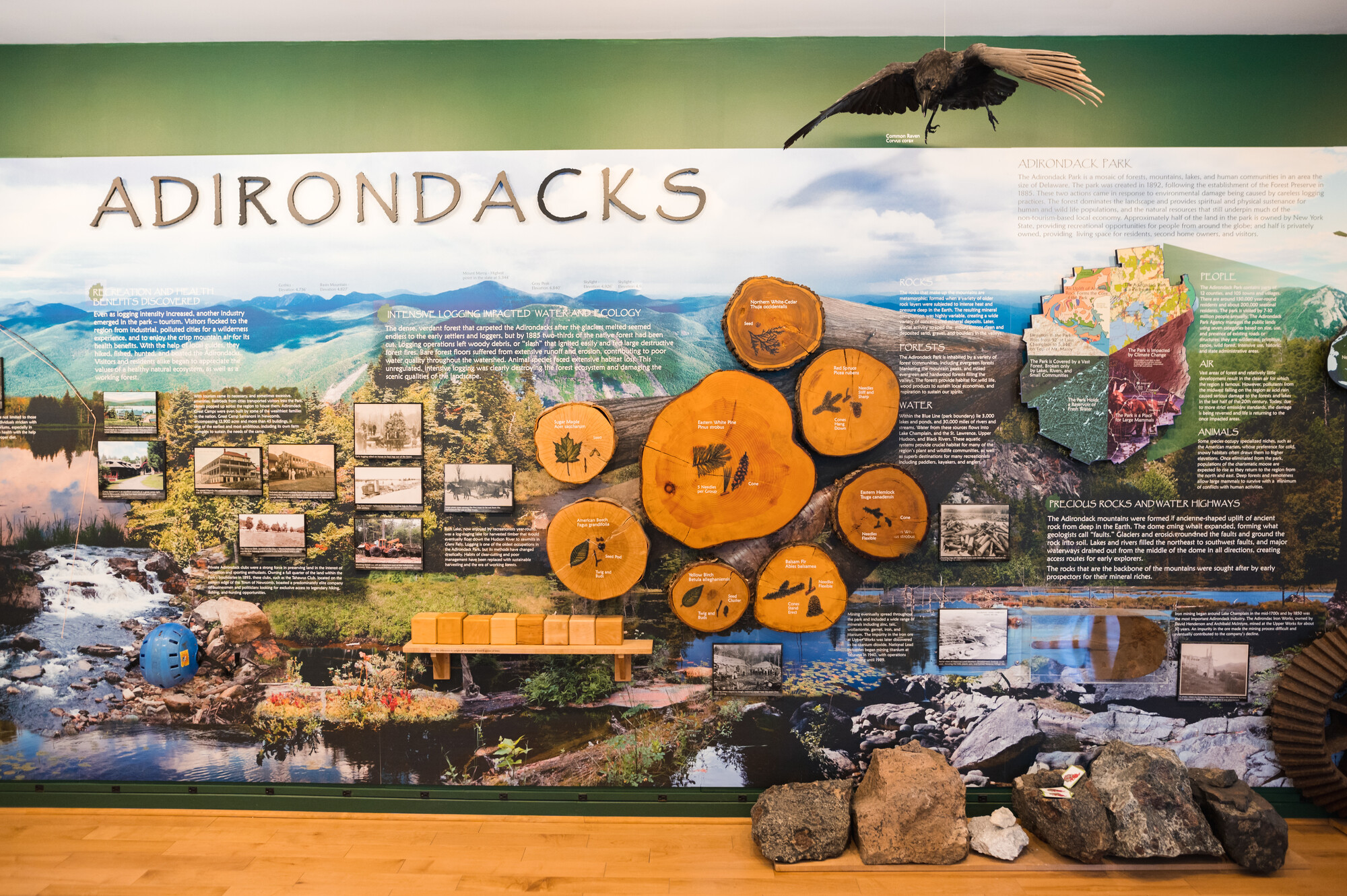
Paul Hai, who leads the education and outreach programs for the Northern Forest Institute and also manages the AIC, arrived and we sat down to chat in the brand new Northern Forest Room. It's a warm and cozy room with comfortable chairs, exhibits and an interpretive wall which is beautifully done with illustrations and photographs and interactive items. There's a real, stuffed black bear in one corner, inviting you to touch it carefully. There are touchable animal skins, a few stuffed birds, interactive displays and four very large picture windows looking out on the forest with bird feeder rigging. There were no bird feeders that day - I suspected because bears are still out and about and would probably be attracted to them at this time of year. (Reminder to yourself: don't put your birdfeeders up until you're pretty sure the black bears are hibernating. There isn't much they like more than sunflower seeds and they'll do anything to get at them!!) Around the beginning of November there will be a suite of 6 feeders as well as an outdoor microphone and indoor speaker system so you can watch and even listen to the birds in the comfort of the Northern Forest Room. Pretty cool!

[img:img-7147.jpg]

[img:img-7148.jpg]

AIC programs

Paul and I talked about the rich history of the region as well as the Center itself and the programs it offers throughout the year. Some of its programs are art-based, such as the artist-in-residence program which has included painters and sculptors working on site at the AIC during the summer months. There are winter full moon ski and chili parties, programs for kids and adults alike, and school programs for groups as well as a wonderful program I'm dying to join - guideboat tours (more on that below).

The directors of the AIC have found that most people like immersing themselves in their own sense of discovery on the 3.6 miles of trails surrounding the Center, independent of the programs they offer. You're free to wander the whole property at your leisure and enjoy the solitude, beauty and wildlife it boasts. There are always staff on hand to identify things you'll find around the Center or on the trails, to answer any and all questions you might have, or to just leave you on your own.

One fun event during the year is the Northern Forest Festival on May 28 (the festival takes place annually on the Saturday of Memorial Day weekend). A highlight of the festival is the Rubber Loon Race fundraiser where small rubber loons, which are numbered, are dropped off the bridge and race downstream to the finish line. Loons are sold by number via raffle ticket and the winning number pays off some great prizes to the "owner" of that loon. Lots of fun.

The AIC also offers the Huntington Lecture series in July and August, featuring topics about research and science going on in the Park. The topics range from bears to roadkill (honest).

AIC has also created programs to share information on the different ways visitors and residents recreate outdoors, including low intensity use activities such as hunting, trapping, fishing and related activities. Check our calendar of events regularly for special programs and events held at the AIC. Or visit the AIC website for more information.

Historic guideboat program

The AIC has acquired two locally historic guideboats which have been restored to their original beauty. The Center has initiated a Guideboat Program where they will take groups out on guided canoe and guideboat trips. This is included in their kids programming as well. They're in the process of adding some additional historic guideboats to the fleet. The kids will get to paddle or row their own boats and hear some great history about the boats they are rowing as well as information on lake ecology, invasive species and more. This is a hands on activity on the water with conversations about forestry and the human and natural environments, and how they change and how they've been impacted. It is a unique program in that there are few if any like it in the Adirondacks taking place in an historic guideboat on the water. The program is also open to anyone who wants to go out. All you have to do is call 518.582.2000, or email the Center to make arrangements for family or other groups from one or up to six people.

[img:img-7234.jpg]

You will thoroughly enjoy yourself on a vist to the Adirondack Interpretive Center and shouldn't miss the opportunity. Take some time to sit by the lake and take in the magnificence of the surroundings. Look for birds in the trees and drink in the serenity and beauty of the Adirondacks.

After leaving the AIC we stopped and had a great lunch at the High Peaks Kitchen and Campground in Newcomb on Route 28N. The food is great and inexpensive and the service is terrific.

Stay and explore

What better way to explore the ghost towns, back roads, and everything the Schroon Lake Region has to offer than spending a few days? Check out our lodging options and book a stay while you do your exploring. See you in the woods somewhere!

Lazy Sunday Ride: It's Tradition

It's tradition: Scenic Driving

Long before cell phones and high-speed internet, back in the day when you couldn't google directions, my dad and I had a Sunday ritual. We would leave our camp on Hoffman Mountain, and "go for a drive." My dad would proclaim this statement like clockwork, let's "go for a drive" ... when I was younger it brought on the sighed reply of "okayyyy" - I couldn't act like I enjoyed it, that wouldn't be cool. But honestly, we didn't have electricity or running water for many of our years at camp, so I never really minded these excursions into the world.

We would head out into the surrounding Schroon Lake back roads. No plan in mind - we'd just drive and stop when something looked interesting. We loved to explore the Adirondacks, and I have many memories of discovering cool things ranging from a ghost town to finding the perfect secret swimming spot.

[img:img-1766.jpg]
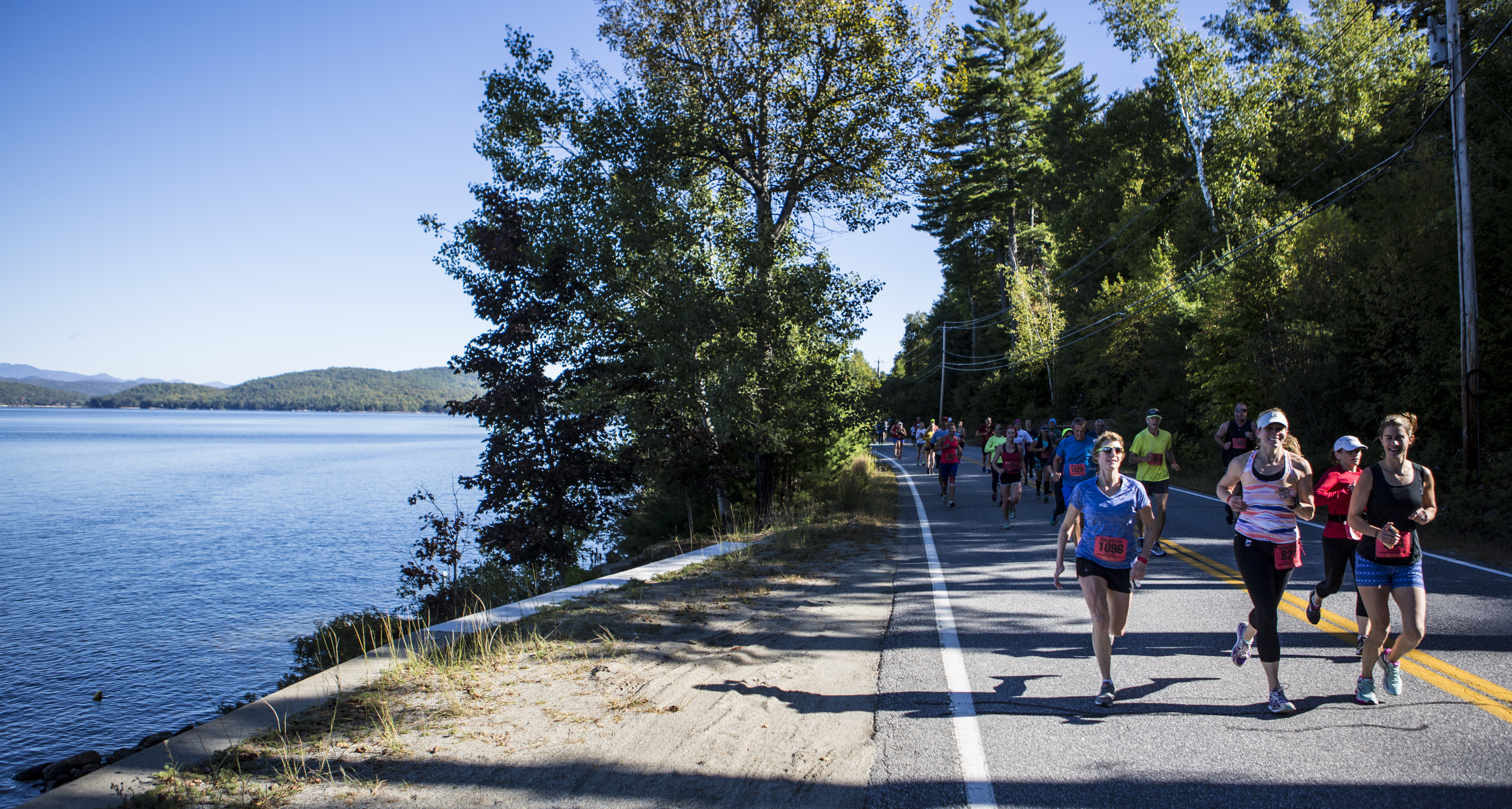
This week on a beautiful early-fall day, in the tradition of my childhood, I took to the roads - with no solid plan in mind. I remembered that I used to love driving over Route 74 toward Ticonderoga (I confess it's because it was the closest "big" town, and had some cool things like a Fort to visit!). While this isn't a real back road, I was by myself today and on a bit of a time constraint, so the thought of getting really lost (a distinct possibility in my world) was weighing on my mind. Plus, if memory served, there was a place in the road where, at certain times of the year when the snow had melted or it had rained a lot and the lakes were full, it almost felt like you would tip the car into the water. I was going to go in search of that spot and see what I found on the way.

[img:img-2422.jpg]

The sun is shining, the top is down on the Jeep, and the radio is playing - I am ready! Starting from the one-and-only light in town, located at the intersection of Routes 9N & 74 at the base of Exit 28 from the Northway, I head east toward Paradox. And, since a traditional Sunday drive is all about the view, I took lots of pictures for this blog - hey, they speak louder than words or something like that anyway, right!?

Today's only guiding principle: If it looks interesting, stop.

Playing it by ear, I was just meandering along when to the right I saw a trail marker and decided to stop. Pharaoh Lake Wilderness Area!? Hey, I have read about this place - Spencer has written a family-friendly hiking blog about it... SOOOOO... this is how you get to Crane Pond and Pharaoh Lake!
[img:img-2326.jpg]
Now, today's blog is about riding, not hiking, but I suddenly have a plan. I am going to check out any of the Trail Markers that catch my attention so when I have more time I can come back and hike the ones I am interested in.

I continue along 74 and not long after to the left I see my next trail marker. It indicates driving down a little road for 1.0 mile to reach Peaked Hill Pond. Sounds like a plan. I drive down a bumpy road that leads to an awesome boat launch I didn't know existed!

[img:img-2330.jpg] [img:img-2331.jpg]

[img:img-2335.jpg]
What a day to be on the lake! But... again... this is about the drive, so off to my next discovery! I head back up to 74 and take a left. A few more miles down the road I see my next big marker on the right side (who knew the 18 mile stretch between Ti & Schroon Lake would have this many public trails!?). It is another pull-off for the Pharaoh Lake Wilderness, this time for the Short Swing Trail - yet another section of wilderness I remember reading a blog about!

[img:img-2344.jpg]
I stop to talk to a few hikers at this juncture. I had noticed within a mile or so of getting to this spot that the air had become quite smoky and it smelled like campfire. The hikers asked me if I had noticed it - they were a bit concerned, it has been a dry season afterall. Luckily another passerby confirmed it was a controlled fire. We talked for a few more minutes and it was time for me to bid them happy trails. (*see addendum at bottom)

Off to my next stop. Where will it be? I don't know, but here we go... another right-hand turn is soon on the docket.

[img:img-2349.jpg]

JACKPOT! Adirondack Treasure: Found

This, this is exactly what a Sunday drive is all about. If I see nothing else today, this week even, I am content. EAGLE LAKE Fishing Access Site. I don't usually fish, so I normally wouldn't stop at a Fishing Site. What a mistake I have been making. Big, BIG mistake. As soon as I pull in I am taken with the beauty of this serene little spot. There is a parking lot with a half-dozen or so vehicles - yet it is almost like I am here alone. The leaves are just starting to change colors, and I am drawn to the little dock.

[img:img-2347.jpg]
I am so glad I decided to stop! To the left the lake opens up and in the distance I could just make out a couple of paddlers.

[img:img-2358.jpg]

To the right was this beautiful, wild section of lake. I am not a fisherman - but I would guess the "big one" might be hiding in this picturesque section of the lake.

[img:img-2361.jpg]
I sit for a few minutes and take in the view. I breathe deeply and appreciate every little detail of the day. I love the Adirondacks. I truly do. It doesn't matter that I left the house a bit stressed this morning, as I take in my surroundings I can be nothing but thankful for all the peace I am afforded by just walking out of my door and into nature. Goodbye, stress.

[img:img-2375.jpg]
I am soon joined by another traveler. We exchange beautiful day pleasantries, and I decide to move on - it's time to let someone else enjoy the solitude.

[img:img-2379.jpg]

View from the Road

I only have a few more minutes to spare before I must change direction and start making my way back toward home. So I decide I will drive for another couple of miles and then call it a day. And, that's when I see the sign (yes, I pulled over quickly to take a pic!) - this must be the place of my fall into the water memory!

[img:img-2383.jpg]
And, there it is... Eagle Lake. Water on both sides and a fun little turn.

[img:img-2384.jpg]

[img:img-2399.jpg]
Fortunately I was able to pull over & snap pics from the here. Unfortunately, before I actually made it the best viewing spot in the center of the lake, there was traffic around me. So, you'll just have to take the trip yourself and enjoy the actual view!

I drove a bit further and came to my last trail marker spot - this is on the right before the road starts climbing in anticipation of its long descent into Ticonderoga.

[img:img-2385.jpg]
I didn't drive in to Putnam Pond this time, I reluctantly needed to turn around and I had already pushed 10-minutes past my designated self-imposed time limit. However this is a great place to hit the next time you're in the area, I camped there a couple of years ago and it's quite a nice little spot for the family. There are a good number of trails that start from the parking lot, and some amazing views.

[img:img-2392.jpg]
Whether you decide to get out and explore on foot, or enjoy the view from the comfort of the car, Schroon Lake Region has so many great roads to explore. I urge you to get out and discover your own secret spots - of course, you should take lots of pics and share them on our Schroon Lake Region FB page!

Full Circle

And, as I was inspired to do this trip in the tradition of my father, it seems only appropriate to end it as he would have. After a day out exploring, we would visit the Mt. Severance Cemetery to pay our respects to our family. Now, resting in the shadow of the mountain of one of our favorite family hikes - I stop to pay my respects.

[img:img-2411.jpg]

Hit The Road

I am so grateful that my Dad introduced me to the Adirondacks when I was a child. Oh, the memories! Ready to make your own? Book your lodging now - it's the perfect time to catch the fall foliage in full splendor!

[img:img-2371.jpg]

* Sadly the information passed along regarding the smoke was incorrect. While there was no cell phone coverage in that particular area of my trip, I later went back to research and learned a valuable lesson - be careful, if something looks suspicious check it out - better safe than sorry. As mentioned is a dry season, and unfortunately the smoke was the beginning of a forest fire caused by an unattended campfire. As of print time, it has burned over 100 acres of Adirondack forest. Here is a screenshot of the NYSDEC post.

[img:screen-shot-20150929-at-90312-am.png]
The latest AP report (as of Mon, Sept 28):

SCHROON (AP) — State forest rangers are battling a growing wild fire in the eastern Adirondack woods that has scorched about 100 acres since an unattended campfire sparked the blaze over the weekend.

The Department of Environmental Conservation says about 14 forest rangers are fighting the fire Monday at Bear Mountain in the Essex County town of Schroon (skroon), 80 miles north of Albany.

DEC officials say county 911 dispatchers received word of a fire around 1:20 p.m. Saturday in the area of Crane Pond in the Pharaoh Lake Wilderness.

Sunday afternoon's dropping humidity and winds gusting to 20 mph caused the fire to spread over 80 acres.

A state police helicopter and local firefighters have been helping contain the blaze.

No injuries or damage to structures have been reported.


Pause
Current Time0:00
/
Duration Time0:00
 
Loaded: 0%
Progress: 0%
0:00
Fullscreen
 
00:00
Unmute


What's your ADK ride?

Take your top off - or roll down the windows!

Cruisin’ the country.

Biking the Blueberry Hill trails: best make a day of it.

Who needs plans!?

Pedaling: the long (or short) way to serenity.

A Sibling Rivalry: who's the favorite?

The Famous Brothers

The siblings are a Little Sister and Three Brothers, and even a first cousin would be thrown into the mix. The “who” that would be the favorite is in terms of views. You see I am not talking about a family rivalry here, but a set of five peaks all in a row that a buddy and I would explore in Brant Lake. Both Jim and I had read on several occasions about The Brothers and even seen a few pictures, this whet our whistle to get out there. We had flirted with the idea of making the drive down to Brant Lake just for this occasion, but more often than not we ended up doing something much closer to home, not involving a 2.5 hour drive (one-way I might add).

We weren’t sure exactly how long this adventure would take us, but we did get word that a decent path was developed up and over at least four of the mountains, Brace Mountain (the cousin) would surely be a bushwhack. With that in mind we passed on the “early bird gets the worm” idea and slept in a bit and settled on a later start of 9:00 am. You see there is no direct route to Brant Lake from home, for either of us, and coming in from opposite directions we couldn’t even carpool. Even if we could have, we had planned a traverse where two cars would be an essential part of our day.

[img:P1015150.jpg]

We met up at the state boat launch site on Brant Lake and Jim followed me to a parking area off Route 8. The parking area sets at the base of Brace Mountain, which was our final peak planned, and Route 8 was where we would emerge from the woods. We then piled into one car and drove over to Palisades Road where a small finger of state land would access us the mountains. We found the paint blazes on the trees and what appeared to be the herd path. With room for only one or two cars along the shoulder of the road I managed to get the entire vehicle off the road - and being parked on a sharp corner that was important.

Heading up Little Sister

The trail started climbing right out of the gate as the flagged herd path followed the state property line. It was steeply graded but quickly leveled out once we hit the ridge. We got slightly off track as the path split away from the state property line, and we ended up having to back-track a little bit because we missed that separation. Once we were on it again, we had no trouble following it to the summit of Little Sister. Little Sister isn’t an official name for the smaller summit along the ridge but Barbara McMartin referred to it as “possibly the Little Sister,” so we just went with it. We were still slightly in the morning clouds but the lingering ones were burning off fast. In fact, as we waited, we could start seeing the mountains behind Brant Lake starting to peek through; it was quite majestic. From here we stayed atop the ridge on another faint path, also flagged, but much more difficult to follow.

[img:P1015154.jpg]

Now off to the First Brother

We made a heading right at the First Brother which set at around 1650’ in elevation. As we progressed over the ridge the open rock started to appear and we had amazing views out over Little Sister to Brant Lake beyond. The clouds have now burned off and we had hazy views for miles. If was kind of like looking through a glass of skim milk. It was getting very hot, and as the saying goes “it’s not the heat but the humidity,” I can vouch for that.

We stayed right as to not miss additional views, but quickly the path started to disappear and we wanted to get back on it. The First Brother was layered in sweet fern; the pungent smell overtook our senses as we pushed through its entwined branches. We eventually came back to the trail as it led us close to the summit of the First Brother, but of course we needed to tag the wooded top.

[img:Brant_Lake_from_the_First_Brother.jpg]

The Second Brother awaits

The trail now descended before us - not all that steep, but very slippery in spots as the oak leaves made for a natural slip and slide. One instance of a slanted rock shelf got the best of me and my awkward flailing to catch myself ended up in a twisted heap at the base. Luckily all that was injured was my palm on my left hand which received a slight case of road rash, or trail rash might be a more appropriate title. Slightly bleeding, I knew I would have fun holding my trekking pole for the remainder of the trip but I just rubbed some dirt on it and dealt with the inconvenience.

Soon we stood at the base of what appeared to be a fine view, but we needed to get there first. The slopes were crazy steep, which we didn’t have to use, but good fun is in a wilderness scramble. The oak leaves again caused a bit of concern as they spread out over some unstable moss, but with carefully chosen foot placement we worked our way up on all fours. We rested atop a stellar viewing area at a makeshift camp created from local stones. Two chairs and a fire pit were erected from slabs of free rock, a nice conclusion to a steep climb on a humid day. We sucked down another bottle of water before we pressed on to the wooded summit of the Second Brother.

[img:P1015174.jpg]

[img:P1015167.jpg]

The Third Brother stands tall at just under 2000-feet

The herd path blazed in red dots was making us uncertain of its destination and since we had not been here before we didn’t know what to think. Too many times bushwhacking we had followed blazed trails only to be led off the wrong side of the mountain. We didn’t want that to happen. We followed for a ways but it seemed to veer off to far left and drop off the ridge and not head toward the Third Brother. We opted to bail on the herd path and head right for our destination atop the fourth sibling.

We managed somehow to get pulled off the ridge and had to climb our way back up, and atop the ridge we found that red dot trail again, I guess it did go in that direction after all. We followed it as is it led us over the ridge with great views of the Third Brother. We could see the open rock on this side of the mountain and it was imperative that we find it. We were quite sure that the red dot trail would head right up the gentler slopes of the ridge and not approach the steep open rock. We stepped back into hardwood forest and headed right up the steep face of the mountain. The jumbles of rocks and odd footing pushed us back left and as we neared the base of the open rock we ended back up on the red dot trail again, we just couldn’t win.

[img:P1015179.jpg]

The red dot trail actually brought us right to the open rock and directly up it. Taking in the countless views we slowly made our way up to a large open field of rock and sedge where views off to the east were just as fine. The summit once again was wooded but the views we had along the way made that so much less important.

Bracing ourselves for the final peak

As we approached the end of our day we had one mountain left before we could descend directly to the car, and that was Brace Mountain. We had no idea what Brace would offer us, possibly nothing more than a nice walk in the woods. The descent was easy as we passed over open rock and through open hardwoods and quickly we stood at the shore of Spuytendulvel Brook, yes that’s how it is spelled, not exactly sure how to pronounce it though; I guess it’s a good thing I am writing and not reading. This brook is a massive width of rocks and boulders. Well over 12-feet wide but only a trickle was flowing through it. Our maps showed a wetland about 0.2 miles upstream and our love of ponds and wetlands drove us to check it out.

[img:P1015186.jpg]

[img:P1015188.jpg]

We rock-hopped the 0.2 miles and found ourselves at a wonderful location with outstanding vistas out over the beaver swamp. A few pictures were in order and then we would climb the steep slopes of Brace that came right down to the shore. The climb was all we could bear at the end of the day. Tired and overheated we pressed on ever so slowly to the summit of the wooded peak. Part of me wanted to check out the lower summit of the mountain, but a larger part of me just wanted to get back to the car to get a cool breeze flowing over my face.

We descended in a quick fashion, side-hilling the super steep slopes, playing amongst boulder jumbles, hanging from partially decayed trees, and jumping from lip to lip. And, we made it to the valley below with only one mere slip and tumble. From the valley we had a relaxing walk in the woods as we finished off the remaining half a mile to the car.

[img:P1015189.jpg]

It was now time to head back into Schroon Lake, an important stop for an ice cream cone and a much needed ice cold drink. The remaining water in my pack was close to that of bath water and that, my friend, was just not acceptable.

[img:Brothers.jpg]

Welcome to Hiking


By: Kathryn Woebber Behuniak

I’ve been hiking for so many years that I’ve forgotten the excitement and freshness of being new to the mountains. One good way to get that feeling back is to take a new hiker into the woods. Hubby and I had family visiting from Buffalo, where there aren’t too many mountains. Our 14-year-old nephew Jonathan had never climbed anywhere in the Adirondacks and our job as a responsible aunt and uncle was to introduce him to the mountains we love so much.

Goodnow Mountain’s Fire Tower

The day was overcast at the start, with leftover sprinkles from a soaking shower the night before. That meant the hike started out wet, but Jonathan didn’t seem to mind. He was wearing borrowed hiking boots and I was concerned the size might not be exact and he’d get a blister. Any small thing could turn someone off to hiking right from the start and I didn’t want that to be the case. But he wasn’t bothered by the borrowed boots either. In fact, he was taking to this whole hiking thing like the proverbial fish to water and I think we were actually holding him back. When he offered to carry my fully laden backpack, I turned it over to him in an instant, quickly learning that having a Sherpa is very nice, indeed! I made great time up the mountain without the weight of lunch, snacks, water and my camera. Better yet, the weight of the pack didn’t slow Jonathan down at all, and it gave him the full hiking experience!

[img:dsc-0855.jpg]

Our group of three made it to the summit in about an hour. I’d hiked Goodnow many times before and this was a pretty quick trip by my standards. It must have been because I wasn’t carrying a pack, but it also could have been because I didn’t want a new hiker to show me up so I just had to keep up with the teenager! For a brief time, we had the top to ourselves. We knew a rather large group was on the way (because we passed them on the trail), so we took advantage of the solitude and climbed to the top of the fire tower before it got crowded.

In the 1900s, mountains with fire towers were the homes of fire wardens who usually lived in a cabin near or on the summit. The wardens would keep an eye out over the surrounding area for fires, oftentimes as a result of lightning strikes, and they would communicate with wardens in other nearby fire towers. The practice was abandoned later in the 20th century, but many of the steel fire towers remain. In this age of lists and challenges, such as becoming a 46er or a Saranac 6er, there is also the Fire Tower Challenge. Goodnow Mountain is one of the peaks on that list. Unlike some other tower topped summits, Goodnow’s tower and cab is fully accessible. Actually, there isn’t much of a view from Goodnow’s summit unless you climb at least the first two sections of ladders. On a windy day, reaching the tower’s cab can require calming some nerves if you have a real fear of heights. Fortunately, this was not a windy day.

[img:fire.jpg]

Conquering Fear

Jonathan had told us before the hike that he was afraid of heights. We assured him that standing on the mostly enclosed, treed summit would not cause any anxiety. We also told him about the fire tower. He was pretty sure he wouldn’t want to climb it. Hubby, who shares his nephew’s fear of heights, coaxed Jonathan about halfway up – his usual stopping point. I was already in the cab. On his own, Jonathan decided to make a run at the tower. He did it – albeit nervously – and was able to enjoy the 360-degree views of the High Peaks, Goodnow Flow, Rich Lake, and the Town of Newcomb. Then he scurried back down. One of the great things about getting kids out on the trails is building confidence without pushing, and letting them realize they are capable of far more than they think. I think Jonathan was pretty proud of himself for conquering his fear and we were happy to help him along.

[img:fear.jpg]

Remembering Earlier Hikes

As we made our way back down the mountain, I was reminded of the days when our kids were young and we were new at exploring different peaks. We started with very small walks in the woods and worked ourselves up from there. Severance Hill, just north of the Village of Schroon Lake, was one of the first hikes our family tried. When you’re introducing someone to hiking, you want it to be fun and interesting. The trail for Severance starts by walking through a large culvert pipe under the Adirondack Northway. What could be more cool than listening to cars roaring by overhead? And after just over a mile, you’re at the summit with magnificent views of Schroon Lake. Fun and interesting. The bonus for our kids, and the incentive to hike back down under their own steam, was the promise of an ice cream somewhere. In Newcomb, after Goodnow, that ice cream was at Scoops on the corner of Route 28N and Bissell’s Loop, at the Campsite Road.

Hiking with Jonathan, and seeing his willingness to explore, reminded me of why I hike. I remembered those nights before a big hike when I could barely sleep because I was so excited to get on the trail. It sounds crazy since we were usually getting up around 4 a.m. and the day ahead promised to be very long, but it was like the night before Christmas to me. I was going to be spending time with my family, doing something I loved. Sharing the woods with people you care about is a lot of fun. Sharing the hiking experience with someone who’s never done it before, and having him enjoy it just as much, feels awesome. And I’m pretty sure Jonathan enjoyed it, because afterwards he proclaimed, “I think I want to hike Mt. Marcy.” And so it begins for another new hiker.

[img:tree-rock.jpg]

Ready to hike your first peak? Whether you want to do a quick family-friendly loop or a longer, full-day adventure, the Schroon Lake Region has plenty of hikes to choose from!

Awesome Cave, Peaceful Trail, and Some Pretty Cool Rocks


[img:cave.jpg]

It was a gorgeous day in the Adirondacks when my boyfriend, David, and I took a trip to the Natural Stone Bridge and Caves in Pottersville. It was 72 and partly sunny, perfect for a little hike in the park, and I was itching to experience a new area of the Adirondacks I hadn’t seen yet in my two months of living here.

Although the Natural Stone Bridge and Caves is a well-known Adirondack attraction, even David (who is a local!) had never been there. When he told me about it, I knew it was someplace we could enjoy together, since I still can’t do hard hikes because of my knee surgery, so we packed up and set out for our little adventure.

Our drive took us south on 87 from Keene, so we passed through Schroon Lake and the mountains as they begin to change colors. It was a beautiful site to see.

When we arrived at the park, it was full of families out to have a great day in the mountains. One of the first things I noticed were these caveman statues around the park, each holding a stone in one hand. Of course, I couldn’t resist taking a picture with one!

[img:caveman.jpg]

After we parked, we signed in at the front desk located in the gift shop, and got our orange bracelets to show we were allowed to be in the park. Jill and Heather, the two ladies who were working, gave us a map of the park and showed us the way to start, out the door of the shop and onto the hiking trail. But before we could leave, we were drawn to the smooth rocks on display, which were for sale as souvenirs after a walk in the woods. I definitely was brought back in time, to when we used to travel to the Adirondacks as a family when I was little. My brother, sister, and I always left our vacations with souvenirs like those rocks, because it was so different from what we would find at home. We always argued that, although we might have dozens of smooth, shiny rocks from past vacations, we needed one more to complete our collections! I reluctantly walked away from the display, but it was time to get outside and begin our tour.

[img:stones.jpg]

As you enjoy the tour of the park, there are a ton of activities for kids to participate in. Gemstone and Gold Rush mining would have been activities I would have wanted to do when I was younger (ok, I admit it - I would have liked to have done them now!). Each person gets to sift through a pile of rocks, with a screen and water, looking for that valuable gem, or dig in a dark mine for gold! And, if dinosaurs are of interest, there is also a dino dig! I would have just stayed there, but I knew there was a lot to explore. Before we got too far along, I enjoyed a Stone Bridge introduction to Disc Golf, and would have loved to play the full course if time would have permitted. I also would have loved the caveman/cave kid challenge bouldering walls, if my knee was up to it!

[img:dino-dig.jpg]

[img:rock-wall.jpg]

We were told to plan on about an hour for the ¾ mile tour of the park, and I was excited to get going. Throughout the trail, there are small green numbered markers, describing where you were and also what you were seeing. My favorite was marker #6, known as Meditation Isle. The description explained the history of the Natural Stone Bridge, and the formation of Fiddlestring Falls and the Flowstone. Even though there were quite a few people, the site was peaceful and relaxing.

[img:green-box.jpg]

To get from one side to the other of the tour, the path led you through the stone bridge arch. It was a tight, dark fit. The caves are formed from marble, not the limestone you would typically see in cave formations, and they are very different from what I expected. I did wish I had taken a walking stick, however, since the ground was a little wet in some areas, and a little slippery!

[img:arch-rock.jpg]

My favorite part of the tour was peeking in the potholes in the rocks – because many of them had little creatures in them! We saw a little snapping turtle just sunning himself on top of the water. The Weeping Wall was an interesting sight, just dripping water constantly, with no real water source that I could see. The rocks there were all covered in moss. We walked down into surface caves and also found some quiet, dark pools that were so cold I got goose bumps! It was nice to take our time, looking at the different marble and rock formations and enjoying the quiet of the tour route.

[img:potholes.jpg]


[img:weeping-wall.jpg]

When we finally reached the end of the tour, we landed in the gift shop, which conveniently sold homemade fudge (my favorite!). It was exactly what we needed to finish off our adventure at the Natural Stone Bridge and Caves. Next time we go, we’ll be sure to visit the Adirondack Memories Museum, and remember to grab a lunch to enjoy by the picnic area.

[img:fudge.jpg]

Things to know: The Natural Stone Bridge and Caves is not only a fair-weather activity. Last season one of our bloggers hit the trails for a snowshoeing adventure through the well-groomed trails - it was a great time! Also, before you go, remember it is a rugged trail, so strollers are not permitted. Neither are dogs, but the Park staff does offer two kennels for dogs if you need a place for them to stay while you explore. The Park hours vary with the seasons, so check out the website.

Success!

You have successfully entered this contest. Be sure to check your inbox for your customized travel inspiration.

Success! Message Sent.

Thanks for being awesome. We have received your message and look forward to talking with you soon.

Thank you!

Thanks for being awesome. You can now download the guide.