When it comes to exploring there isn’t much I won’t do to find that hidden gem or secluded view, and in doing so I sometimes don’t use my best judgement. Of course most days start out with a solid plan, and that plan usually works out to be a good one and we go with it, BUT...
Simply put, the winter of 2016 has not been all that predictable and snow conditions have varied quite a bit. We had a plan to head south of Schroon Lake, back into the Lake George Region for this little outing. The peaks we eyed weren’t far from Schroon Lake, so the drive was an easy one and we quickly found ourselves at the Deer Leap Trailhead, our meeting spot.
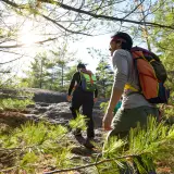
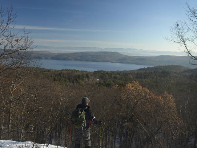
Arriving in the Lake George Wild Forest
Back to the plan: We were going to hike up and over a couple of mountains and finish off on Bloomer Mountain, which is right near our meet-up spot. Once we started going to the other trailhead we found out it was not plowed and this would add some distance to our hike. I decided rather than rush the day, which was getting older, we would instead venture up onto Indian Mountain and maybe over toward Spruce Mountain if things went OK.
Parking the car along the end of the plowed section of Split Rock Road, we started our trek. We left the snowshoes in the car, placing high hopes that the thick January crust layer would suffice. There was a wonderful contrast between the sky and the snow, and the projected heat of the day was starting to settle in. We arrived swiftly for the meeting at Jabe Pond Road, which was the other road we had hoped would be plowed.
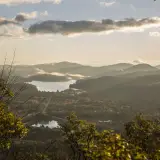
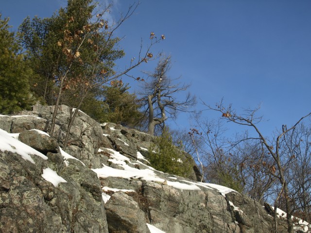
Continuing down Jabe Pond Road on foot, we crossed a hollow and started to climb to a height-of-land. This was our leap-off point for Indian Mountain. This Native American inspired mountain was certain to please as we pondered the rock opening in front of us. We scramble up the slopes, out onto the open rock, and within a couple minutes of leaving the road we were rewarded with an outstanding view of Lake George and the Green Mountains of Vermont. Perched high above the valley we soaked it all in. The sun was starting to soften the snow and we started to leak as well, so removing a layer or two was in perfect order.
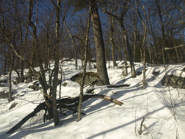
The remaining distance to the summit of Indian was not overwhelming in the least, and along the way we happened to enjoy additional small views in all directions. This summit consisted of a narrow ridgeline with gnarly trees dotting its slopes, a unique atmosphere indeed. Views became slightly screened but we could see our surroundings as the irregular system of mountains they were. We wanted more.
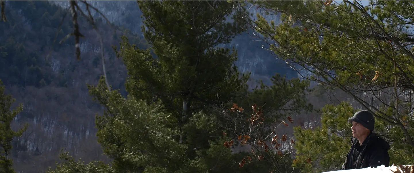
Beavers love the mountains too
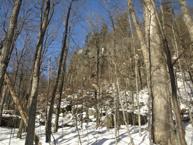
Due to our rapid ascent of Indian Mountain we had time to head over toward Spruce Mountain, but upon further inspection of our map the summit seemed to rest on easement lands. It was unclear if those easement lands were open to the public for recreation (come to find out later they don't appear to be). Nevertheless, we would head in that direction and follow the col out back to the car if need be. During our steep descent off of Indian we gandered at Spruce and noticed an open rock wall with stellar viewing potential well below the summit and well within the state land boundary. We decided to go for it.
The descent continued to be steep, then ridiculously steep, and then a sheer drop. We didn’t expect such conditions on this little guy but with the unexpected comes the adventure. We navigated the top of the cliffs with care and precision, and then eventually we found a safe opening down. The col in between these two peaks of the Lake George Wild Forest was nothing short of breathtaking. A beaver clan had made a small village down there and the flowage looked deep beneath the sheet of ice. I am not a fan of walking on ice, even when I know it is safe enough for a truck, but a truck doesn’t have the luck I tend to have on frozen liquids.
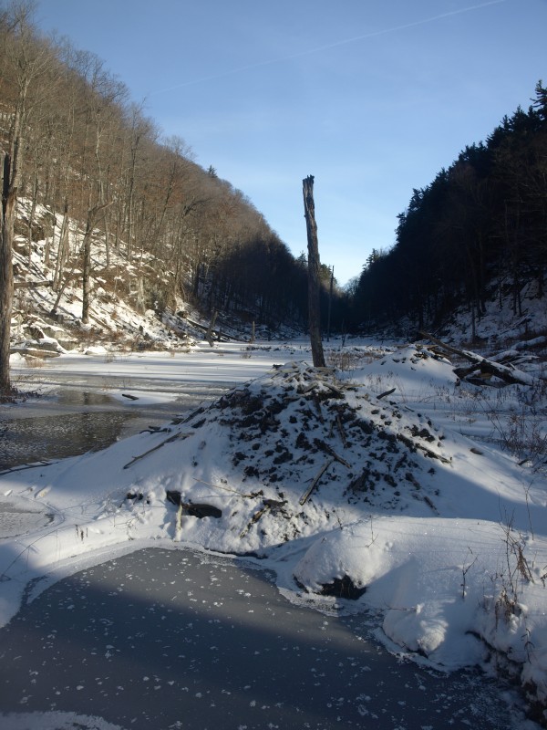
I hugged the shore as I passed over beaver canals and dead trees. Around each bend its openness and picturesque settings were worthy of nothing less than two dozen pictures. I think Jim’s camera caught on fire at one point. Finally I reached a beaver dam — the one causing all my mental chaos — whose structure I trusted. As the ice cracked along the side from my weight prying up on the sticks, I knew I had made the right choice. Jim, on the other hand, didn’t like the security of solid ground and used the ice for a final section. We could hear the cracks beneath him, disconcerting as it was. Clenched up he hurried to shore, dry this time.
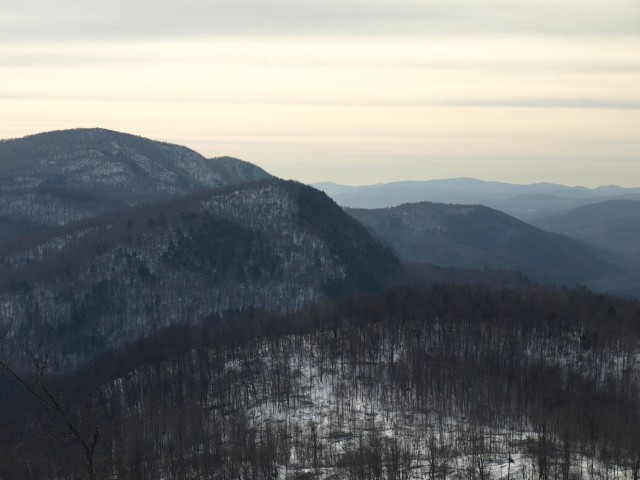
Some of the best views around
We had a steep climb ahead of us, and as the cliffs started to grow closer and closer the terrain began to become an ‘all-fours’ ordeal. We looked ahead to see if we could find a shoot through the rock structure or if we would have to go around. My sense of adventure found a small possibility and we went for it.
Upon wary footing on steep, frozen slopes we slowing reached what looked like an ideal spot from below. I now doubted my intentions. My full winter pack was pulling me back as I fought to get purchase with my boots. Only a small lip aided me in this and that was not all that promising or secure. My camera bag at my hip hindered me and pushed me back from the rock shelf, leaving me unbalanced. I had to remove it. I handed it to Jim, whose property value was a simple foot hold on a tree root. He was not so enthusiastic either. I am not a rock climber, nor do I pretend to be one, but at times the adventure of a tough scramble clouds my good decision. A slip would have meant the production of a Jimbo pancake and a steep tumble of tens of feet to the valley below. A tumble for which I would be truly sore for days, one for which I avoided as I finally had enough grip to push off and step up to a secure location.
It was now Jim’s turn; he would have none of that. He handed up my camera case using our trekking poles and began walking the base of the cliffs looking for a smarter approach to the top. I continued on to complete two smaller scrambles, which were easy in comparison. Upon the rocky ridge I finished off my attack to gain the view, and what a view. Jim found a gully, loaded with snow and a gentle grade, that was a much easier approach than mine.
We hung around this rocky outcropping for nearly an hour with the sun warming our skin and the view warming our hearts. We listened to the raven cawing below us and off in the distance the rat-tat-tat of a woodpecker looking for food filled our ears. With hot beef bouillon inside me warming that portion of my body we had to head off.
We used the state land boundary to guide us off of the mountain. It was hard to locate in most areas, but we did our best not to intrude. Eventually it became easy to follow with tree harvesting right up to the boundary. We continued with moderate descents over welcoming footing, and then came the exit from the forest onto the unplowed portion of the back road. It was a flash for us as we arrived back to the car, grateful for what we were granted — not only wonderful views, but a safe return home. Our rambling in the woods had come to an end and we gabbed about returning for more adventures in the Lake George Wild Forest very soon.
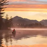
There's plenty to quench your thirst for adventure in the Schroon Lake Region. Go horseback riding, snowmobiling, or downhill skiing!