I had already planned to go to Schroon Lake for a meeting on a recent spring day, but with warm temps and sun predicted, I decided to combine the trip with an outdoor adventure. Itching to spin, I set a goal of riding my road bike around the entire Adirondack Marathon route.
I packed the bike and gear, a pair of sneakers and my briefcase and headed out with enough time to ride the 26.2 miles before my meeting began.
When I arrived in Schroon Lake, I decided to first take a look at the roads via car. This time of year is tricky; the "busier" roads are cleared of sand and salt earlier than the secondary roads. The marathon route covers both types.
I drove onto the first secondary road of the race route, Alder Meadow Road, and it looked summertime-cleared of sand. However, about a mile or so in, I realized why; the town crews were there cleaning the roads that very day. I passed them and came to the junction of Alder Meadow and Adirondack Road, which takes runners south along the eastern shore of Schroon Lake to the Town of Adirondack. At this junction, I realized that my plans would have to change.
This winter, which was great for snow sports as we had a good amount of the white stuff, also required consistent sanding of the roads, and this one hadn't yet been cleared. There was a substantial amount of residual sand in the road; not safe for my skinny tires (especially since I was planning to ride solo).
I quickly switched from Plan 26.2 to Plan 2.4. Luckily, I had brought along my trail running shoes.
I decided to do a short hike instead. With spring weather this beautiful, I had to do SOME sort of outdoor adventure. I had heard that Mount Severance was a short, 2.4 mile round trip classic local hike, so I looked it up on my smartphone and found the trailhead just across the street from the entrance to Alder Meadow Road.
Before I hiked up, however, I decided to obtain some nourishment. As luck would have it, the Mt. Severance Country Store was very close by, adhered to my new Plan 2.4 "Severance" theme, AND they make a mean sandwich, I knew from experience.
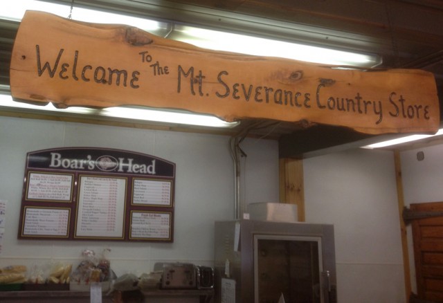
I ordered a sandwich, grabbed a bottled water and headed back out. (I had planned to carry the sandwich to the top and have a picnic, but it somehow disappeared before I arrived back at the trailhead.)
With all the running around I had done, I had actually run out of enough time to do a leisurely hike before my meeting, so I went to work, and returned to the trailhead at around 3:30 p.m. Though there were no cars in the lot before my meeting, there were now 4 vehicles parked at the trailhead. This was a welcome change to me; I'm not accustomed to hiking solo - at least not without my dog.
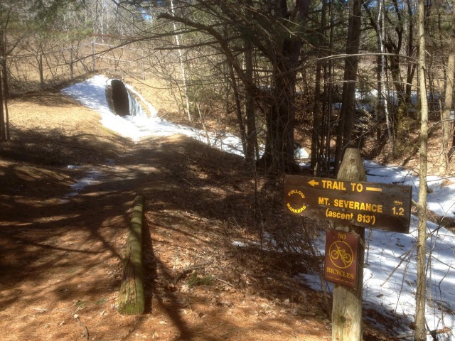
The beginning of the trail is interesting; in order to get from the trailhead to the mountain, one has to cross the four-lane Interstate 87 that goes from Albany north to Montreal. This crossing isn't as dangerous, though, as hikers can access the other side via two culvert tunnels. For those of us prone to claustrophobia, this adds a surprising twist to the adventure.
I made it through unscathed (except for a couple of broken nails acquired by grabbing onto the corrugated wall of the culvert to avoid slipping on a somewhat slippery entrance, due to ice that formed from melting snow. Shoulda worn my bike helmet!)
I signed in at the register located between the two tunnels, and after exiting the second, started up the snow-packed trail. All along the mile or so up to the summit, the trail varied from completely clear of snow in sections to post-holed packed snow in others. There were a few spots that were ice-covered and would have been better tackled with traction assistance like microspikes, but I was able to easily skirt around them.
I passed a few exuberant, smiling families, complete with kids ranging from 2 feet to 5 feet tall, all on their way down as I went up; the passengers in those cars in the lot. I didn't ask where they were from, but given the timing, I bet that this hike is a favorite after school local family jaunt; especially on a warm, sunny spring day.
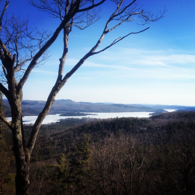
I arrived at the top in less than 30 minutes, and took a few more to enjoy the view of still-frozen Schroon Lake to the southeast. There is apparently another vista that allows views to the northeast; but I didn't find it. As I was definitely hiking solo now, I decided to descend back down the trail; which took closer to 20 minutes to get back to the register.
The sign at the trailhead said that the summit is 1.2 miles from that point (2.4 round trip) and that the ascent is 813'. I used my smartphone app for the hike, and it reported that I had hiked 2.93 miles and gained 1,279' in elevation. (I think the difference reflects my switching on the app at the car, rather than at the trailhead sign.) Regardless, since I didn't get to do the marathon bike, I'm taking credit for the longer hike.
Learn more about the hike up Mount Severance, and check out all of the Schroon Lake Region hikes!
