In the Adirondacks, the past and present are intertwined.
The remnants of old logging camps peek out from under decaying leaves, which provide nutrients for new forest growth. Old buildings lean alongside our winding roads, while the tools used to build them are on display in state-of-the-art museums here.
The wilderness itself boasts a varied landscape where the past and present collide with dizzying force: Landslides carve new paths on steep slopes, revealing ancient rock. Young red maples sprout from cracks in the crumbling stone fences and walls that decorate the backcountry. The forest reclaims its own.
There is no better place to walk through this heritage than the difficult and 10.3-long hike from the Upper Works trailhead to the summit of Mount Marcy. Where else can you see a ghost town, the site of a fatal accident, the place where a former vice president embarked upon a midnight ride, and the top of the highest mountain in New York state all in one hike?
The trek begins on the outskirts of Newcomb. Take Exit 29 off of Interstate 87 and head west on Blue Ridge Road for 17.5 miles, then turn right on Tahawus Road. After 6.5 miles, bear left onto Upper Works Road.
Blast from the past
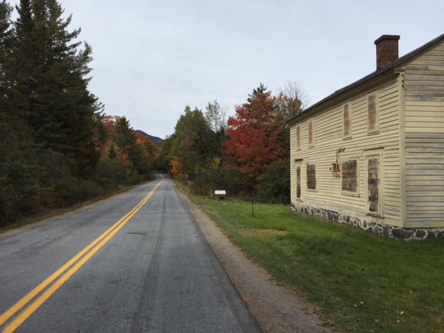
The first stop along the tour happens before you even leave your vehicle. As you drive along Upper Works Road, you'll soon come to a real-life ghost town. This is Adirondac, an old mining town that was once booming with activity.
In the 1939, National Lead bought the mining operation from the McIntyre Iron Company, then rented the 30 vacant Tahawus Club cabins that were on the property to its employees. Those homes comprised Adirondac, and the neighboring mining town was called Tahawus.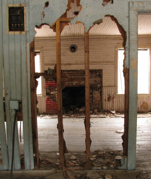
The mining industry hit a boom when World War II started in 1939, and things were great in the Adirondack mining communities. The people in the bustling little towns even kept things lively with friendly competition that emerged in summertime softball games, a scene straight out of a Norman Rockwell painting. When iron ore and titanium were discovered under Tahawus in 1963, the town and its people were literally moved to get at it. Houses were jacked up, loaded onto flatbed trucks, and transported to nearby Newcomb, where many still remain today.
In 1964, National Lead higher ups decided it was time to get out of the landlord business, so the people of Adirondac were also relocated to Newcomb. Their houses stayed put, and the now-abandoned buildings are open for exploration. Take some time to wind through the once-beautiful homes, where trees now stand in place of furniture and the scuttling of animals is more frequently heard than the stomping of feet.
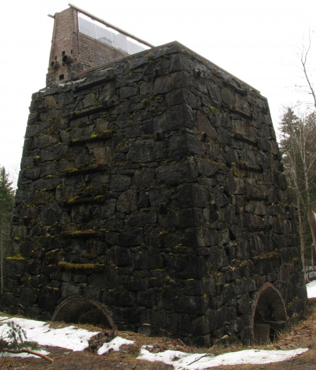
There are other remnants of the mining operation to discover there too, like the enormous stone blast furnace. Cold, tall, and dark, it remains as a silent testament to a bygone era.
An upper workout and a calamity
Once you've finished exploring Adirondac, continue down Upper Works Road, park at the Upper Works trailhead, and head toward Mount Marcy and the Flowed Lands. You'll follow an old logging road, cross the beautiful Calamity Brook on an impressive suspension bridge, and ascend to the edge of the Flowed Lands at 4.7 miles.
Before reaching the Flowed Lands, take care to follow the side path that leads off to the left. It goes 60 feet to the shore of Calamity Pond and the Henderson monument, which memorializes an accident that occurred here 170 years ago.
As the story goes, David Henderson was searching for a water source to power the blast furnaces at the iron works when he accidentally shot himself and died on this spot. The inscription on the monument reads:
"This monument, erected by filial affection to the memory of our dear father, David Henderson, who accidentally lost his life on this spot, 3rd September, 1845."
After the monument you'll soon come to the Flowed Lands, a gorgeous spot where mountains seem to rise from the surface of the water. There are several desirable lean-tos and campsites along the shore, but be forewarned: If you decide to camp here, a bear canister is not a recommendation, it's a necessity.
If you're doing this trip as a day hike, it's best not to linger too long as there are still 5.5 miles of climbing left to reach the top of Marcy. If you do camp, make the half-mile side trip to Hanging Spear Falls. It's worth it.
Marcy bound
Follow the edge of the Flowed Lands, cross the bridge over Lake Colden Dam, and turn right at the trail register to follow the rugged and scenic Opalescent River toward Mount Marcy. At about 8 miles from the parking area, turn right to begin the long, steep climb to the summit. It's uphill all the way from here on out, so make sure you have enough water or a reliable water filter.
Lake Tear and the midnight run
After hiking 9.2 miles and climbing 2,700 feet from the parking area, you'll come to a small, secluded body of water called Lake Tear of the Clouds. At 4,346 feet in elevation, it's the highest pond source of the Hudson River. The rocky dome of Marcy rises behind the pond, and it looks deceptively close even though there's still about 1,000 feet in elevation to go.
The end is in sight, but take a minute to consider the history of this place. On Sept. 14, 1901 then-Vice President Theodore Roosevelt was at Lake Tear after summiting Marcy. It was there that he received a message that President William McKinley — who was shot a couple of weeks prior but was expected to recover — was dying.
Roosevelt made haste to Tahawus, then took a 40-mile midnight stagecoach ride to North Creek, where he learned McKinley had died. Roosevelt boarded a train for Buffalo and was sworn in as president there.
Summit fever
After leaving Lake Tear, you'll soon come to a four-way junction. Straight descends into the wild and remote depths of Panther Gorge, right goes to the summit of Skylight, the fourth highest mountain in the Adirondacks, and left goes to the top of Marcy.
As you leave the forest and enter the moonscape-like alpine zone of the mountain, take care to avoid the vegetation there by staying on the rocks. Many of the plants here are rare and incredibly fragile, so all it takes is a misplaced hiking boot to kill them. Great efforts have been made by the Adirondack Mountain Club's summit stewards to revegetate and protect alpine zones in the region. Please respect their work and gently enjoy this unique ecosystem.
The final pitch of Marcy is a steep, wonderfully open climb to the 5,344-foot elevation mark. The mountain was named after former New York state Gov. William Marcy, who authorized an environmental survey to explore the area in the 19th century. The first recorded ascent of the mountain was August 5, 1837.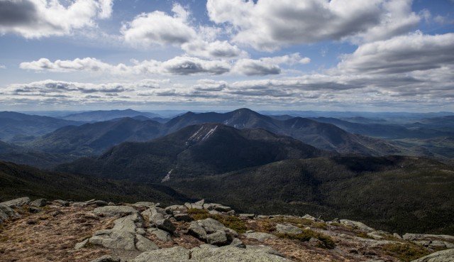
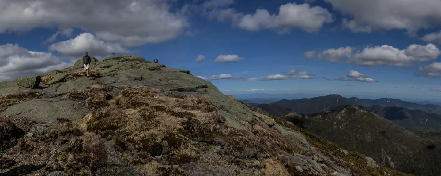
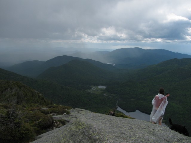
The view from the top of Mount Marcy is one of the best anywhere. The surrounding topography bears evidence of the geologic forces which created this region, the plants growing between the rocks serve as living relics of the last glacier's retreat, and plaques bolted to the anorthosite grantie speak to the recent, but no less compelling, history of human involvement in the area. It's a lot to take in. Oh, and there are mountains, lakes, and forests stretching in every direction.
After your hike, why not grab a bite to eat and rent a room to relax in for the night John Brown lives.
